| This is the current view of Chageen from Google© Maps. This picture was taken during the dry season - probably (to judge from the amount of burn-off) in January. Our air strip is clearly visible to the left. The white spots to the right of the south end of the strip are the tin roofs of the clinic and the other buildings of the Evangelical church compound. Our house is not visible due to the many trees around it. As of February 2011 when we put this page up, the satellite picture on Google does not show the new clinic building which was finished in 2008. We have prepared an annotated Google map with more details about the countryside around Chageen on this Google website. |
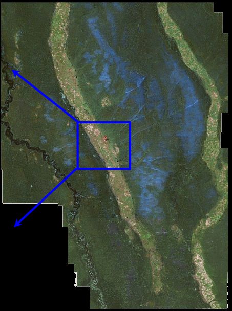
This is a view of Chageen saved from Google© maps in about 2007. This picture was taken during rainy season. Notice the two snake-like geological features. These are ancient sand dunes or ancient river beds which are 10 or more miles in length and half a mile wide which snake across the heavy clay plain. The villages are lined up like peas in a pod along these dunes since they are a few feet higher than the surrounding plain and don't flood in the rainy season. The plains between the dunes flood with about 18 inches of water which is where the Kwong make their millet fields. You can see the paths fanning out from Chageen on the left-most dune to the fields between the dunes. |
|
View Larger Map
|
|